
|
|
Frequently Asked Questions Printer Friendly Version |
|
Closures & Advisories Search Conditions By Map Search By City Search By Route Search By District Variable Speed Limits Chain Law Neighboring States |

| District Comments | |
|---|---|
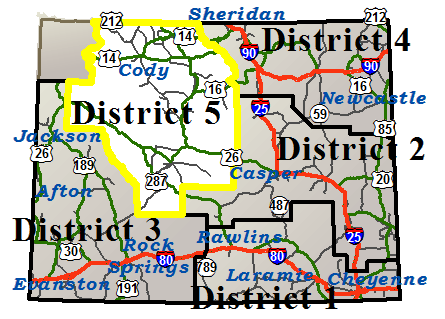
| District 5 (Northwest) | |
|
Basin
NWS Forecast Basin |
|||||||
|---|---|---|---|---|---|---|---|
| Route | Location | Conditions | Advisories | Restrictions | Last Report Time | Cameras | Sensors |
| US 14/16/20 | Between the Big Horn County Line and 4 miles west of Greybull | Dry | None | None | Mar 18, 2026, 07:32 PM |

|
|
| Between Greybull and Shell | Dry | None | None | Mar 18, 2026, 07:32 PM | |||
| Between Shell and Antelope Butte Mountain Recreation Area | Dry | Falling Rock | None | Mar 18, 2026, 07:32 PM |
|

|
|
| US 16/20 / WY 789 | Between Greybull and Basin | Dry | None | None | Mar 18, 2026, 07:32 PM |
|
|
| Between Basin and MM 176, Washakie/Big Horn County Line | Dry | None | None | Mar 18, 2026, 07:32 PM |
|
||
| US 14/16/20/310 / WY 789 | Between Greybull and 4 miles west of Greybull | Dry | None | None | Mar 18, 2026, 07:32 PM |
|
|
|
Cody
NWS Forecast Cody |
|||||||
|---|---|---|---|---|---|---|---|
| Route | Location | Conditions | Advisories | Restrictions | Last Report Time | Cameras | Sensors |
| US 14/16/20 | Between the E Gate of Yellowstone Nat'l Park and Pahaska | Road Closed Due To Seasonal Closure | Mar 18, 2026, 10:06 AM | ||||
| Between Pahaska and the Shoshone National Forest Boundary | Dry with Strong Winds | Falling Rock | None | Mar 18, 2026, 07:32 PM | |||
| Between the Shoshone National Forest Boundary and Cody | Dry with Strong Winds | Falling Rock | None | Mar 18, 2026, 07:32 PM |
|
||
| Between Cody and the Big Horn County Line | Dry with Strong Winds | None | None | Mar 18, 2026, 07:32 PM |
|
||
| US 14 A | Between Cody and Powell | Dry with Strong Winds | None | None | Mar 18, 2026, 07:32 PM |
|
|
| US 212 | Between Mile Marker 4.5, Westbound Closure Gate and WY 296 | Dry with Strong Winds | Falling Rock | None | Mar 18, 2026, 07:32 PM | ||
| Between WY 296 and Beartooth Pass | Road Closed Due To Seasonal Closure | Mar 18, 2026, 10:06 AM | |||||
| WY 120 | Between Cody and the Montana State Line | Dry with Strong Winds | None | None | Mar 18, 2026, 07:32 PM |
|
|
| WY 296 | Between US 212 and WY 120 | Dry with Strong Winds | Falling Rock | None | Mar 18, 2026, 07:32 PM |
|
|
|
Dubois
NWS Forecast Dubois |
|||||||
|---|---|---|---|---|---|---|---|
| Route | Location | Conditions | Advisories | Restrictions | Last Report Time | Cameras | Sensors |
| US 26/287 | Between the E Boundary of Grand Teton Nat'l Park and Lava Mountain Lodge | Wet | None | None | Mar 18, 2026, 04:16 PM |
|
|
| Between Lava Mountain Lodge and Dubois | Dry | None | None | Mar 18, 2026, 07:32 PM |
|
||
| Between Dubois and Diversion Dam Jct | Dry | None | None | Mar 18, 2026, 07:32 PM |
|
||
|
Lander
NWS Forecast Lander |
|||||||
|---|---|---|---|---|---|---|---|
| Route | Location | Conditions | Advisories | Restrictions | Last Report Time | Cameras | Sensors |
| US 287 / WY 789 | Between Sweetwater Station Jct and Jct WY 28 / US 287 | Dry | None | None | Mar 18, 2026, 07:32 PM |
|
|
| Between Jct WY 28 / US 287 and Lander | Dry | None | None | Mar 18, 2026, 07:32 PM |
|
||
| Between Lander and Diversion Dam Jct | Dry | None | None | Mar 18, 2026, 07:32 PM |
|
||
| WY 131 | Between Lander and Sinks Canyon State Park | Dry | None |
Road Closed to Thru Traffic, Local Traffic Permitted
|
Mar 18, 2026, 07:32 PM | ||
| WY 132 | Between US 287 and Ethete | Dry | None | None | Mar 18, 2026, 07:32 PM | ||
| Between Ethete and US 26 | Dry | None | None | Mar 18, 2026, 07:32 PM |
|
||
| WY 789 | Between Lander and Hudson | Dry | None | None | Mar 18, 2026, 07:32 PM |
|
|
|
Lovell
NWS Forecast Lovell |
|||||||
|---|---|---|---|---|---|---|---|
| Route | Location | Conditions | Advisories | Restrictions | Last Report Time | Cameras | Sensors |
| US 14 A | Between Powell and the West Jct US 310 / WY 789 | Dry | None | None | Mar 18, 2026, 07:32 PM | ||
| Between Lovell and 22 miles east of Lovell | Dry | None | None | Mar 18, 2026, 07:32 PM | |||
| Between 22 miles east of Lovell and the Sheridan/Big Horn County Line | Road Closed Due To Seasonal Closure | Mar 17, 2026, 06:57 PM | |||||
| US 310 / WY 789 | Between 4 miles west of Greybull and Lovell | Dry | None | None | Mar 18, 2026, 07:32 PM |
|
|
| Between Lovell and the West Jct US 310 / WY 789 | Dry | None | None | Mar 18, 2026, 07:32 PM | |||
| Between US 310 / WY 789 and the Montana State Line | Dry | None |
US 310 / WY 789 at milepost 257.010 Single unit 4-5 axles: 26T , Single unit 6+ axles: 30T |
Mar 18, 2026, 07:32 PM |
|
||
| WY 114 | Between Garland and Deaver | Dry | None | None | Mar 18, 2026, 07:32 PM | ||
|
Meeteetse
NWS Forecast Meeteetse |
|||||||
|---|---|---|---|---|---|---|---|
| Route | Location | Conditions | Advisories | Restrictions | Last Report Time | Cameras | Sensors |
| WY 120 | Between WY 171 and Meeteetse | Dry | None | None | Mar 18, 2026, 07:32 PM |
|
|
| Between Meeteetse and Cody | Dry | None | None | Mar 18, 2026, 07:32 PM |
|
|
|
| WY 431 | Between US 20 / WY 789/432 and WY 120 | Dry | None | None | Mar 18, 2026, 07:32 PM | ||
|
Riverton
NWS Forecast Riverton |
|||||||
|---|---|---|---|---|---|---|---|
| Route | Location | Conditions | Advisories | Restrictions | Last Report Time | Cameras | Sensors |
| US 26 | Between Diversion Dam Jct and Riverton | Dry | None | None | Mar 18, 2026, 07:32 PM |
|
|
| Between Riverton and WY 134 | Dry | None | None | Mar 18, 2026, 07:32 PM |
|
||
| WY 135 | Between WY 789 and WY 139 | Dry | None | None | Mar 18, 2026, 07:32 PM | ||
| Between WY 139 and Sweetwater Station Jct | Dry | None | None | Mar 18, 2026, 07:32 PM |
|
||
| WY 136 | Between WY 135 and Gas Hills | Dry | None | None | Mar 18, 2026, 07:32 PM |
|
|
| WY 789 | Between Hudson and Riverton | Dry | None | None | Mar 18, 2026, 07:32 PM |
|
|
|
Shoshoni
NWS Forecast Shoshoni |
|||||||
|---|---|---|---|---|---|---|---|
| Route | Location | Conditions | Advisories | Restrictions | Last Report Time | Cameras | Sensors |
| US 20 / WY 789 | Between Boysen Dam and Shoshoni | Dry | None | None | Mar 18, 2026, 07:32 PM |
|
|
| Between Shoshoni and Moneta | Dry | None | None | Mar 18, 2026, 07:32 PM |
|
||
| Between Moneta and Waltman | Dry | None | None | Mar 18, 2026, 07:32 PM |
|
|
|
| US 26 / WY 789 | Between WY 134 and Shoshoni | Dry | None | None | Mar 18, 2026, 07:32 PM |
|
|
| WY 133 | Between Kinnear and Pavillion | Dry | None | None | Mar 18, 2026, 07:32 PM |
|
|
| WY 134 | Between US 26 / WY 789 and WY 133 | Dry | None | None | Mar 18, 2026, 07:32 PM | ||
|
South Pass
NWS Forecast South Pass |
|||||||
|---|---|---|---|---|---|---|---|
| Route | Location | Conditions | Advisories | Restrictions | Last Report Time | Cameras | Sensors |
| WY 28 | Between the Fremont/Sublette Cty Line and Mile Marker 47 | Dry | None | None | Mar 18, 2026, 07:32 PM |
|
|
| Between Mile Marker 47 and Mile Marker 63, Westbound Closure Gate | Dry | None | None | Mar 18, 2026, 07:32 PM |
|
|
|
| Between Mile Marker 63, Westbound Closure Gate and US 287 / WY 789 | Dry | None | None | Mar 18, 2026, 07:32 PM |
|
||
|
Ten Sleep
NWS Forecast Ten Sleep |
|||||||
|---|---|---|---|---|---|---|---|
| Route | Location | Conditions | Advisories | Restrictions | Last Report Time | Cameras | Sensors |
| US 16 | Between Worland and Ten Sleep | Dry | None | None | Mar 18, 2026, 07:32 PM |
|
|
| Between Ten Sleep and WY 435 | Dry | None | None | Mar 18, 2026, 07:32 PM | |||
| Between WY 435 and Deer Haven Lodge | Slick in Spots | Falling Rock | None | Mar 17, 2026, 06:57 PM |
|
|
|
|
Thermopolis
NWS Forecast Thermopolis |
|||||||
|---|---|---|---|---|---|---|---|
| Route | Location | Conditions | Advisories | Restrictions | Last Report Time | Cameras | Sensors |
| US 20 / WY 789 | Between Mile Marker 148, Washakie/Hot Springs County Line and Thermopolis | Dry | None | None | Mar 18, 2026, 07:32 PM |
|
|
| Between Thermopolis and Boysen Dam | Dry | Falling Rock |
US 20 BUS/WY 789 from milepost 116.100 to 116.500 Width restriction: 12 ft Height restriction: 15 ft |
Mar 18, 2026, 07:32 PM |
|
||
| WY 120 | Between Thermopolis and WY 171 | Dry | None |
WY 120 from milepost 5.600 to 5.700 Width restriction: 16 ft |
Mar 18, 2026, 07:32 PM | ||
|
Worland
NWS Forecast Worland |
|||||||
|---|---|---|---|---|---|---|---|
| Route | Location | Conditions | Advisories | Restrictions | Last Report Time | Cameras | Sensors |
| US 16/20 / WY 789 | Between Washakie/Big Horn County Line and Worland | Dry | None | None | Mar 18, 2026, 07:32 PM |
|
|
| Between Worland and Mile Marker 148, Washakie/Hot Springs County Line | Dry | None | None | Mar 18, 2026, 07:32 PM |
|
||
|
NWS Forecast |
|||||||
|---|---|---|---|---|---|---|---|
| Route | Location | Conditions | Advisories | Restrictions | Last Report Time | Cameras | Sensors |
|
NWS Forecast |
|||||||
|---|---|---|---|---|---|---|---|
| Route | Location | Conditions | Advisories | Restrictions | Last Report Time | Cameras | Sensors |
|
NWS Forecast |
|||||||
|---|---|---|---|---|---|---|---|
| Route | Location | Conditions | Advisories | Restrictions | Last Report Time | Cameras | Sensors |
| *Chain Law - Level 1 Definition |
| **Chain Law - Level 2 Definition |
| Other Definitions |
| Impact Levels | Description / Recommended Action |
|---|---|
| Low | Minimal impacts expected, use general caution. |
| Moderate | Some impacts expected, use extra caution. Stay alert for changing road and weather conditions. |
| High | Dangerous impacts expected, use extreme caution, delay travel or consider alternate route. If travel is necessary, slow down and allow extra time. |
| CLOSED | Per W.S. 24-1-109, motorists traveling on a closed road without permission from WYDOT or WHP may be subject to a fine of up to $750 and/or up to 30 days imprisonment. |
| Seasonal / Long-Duration Event | Impact level used to distinguish long-duration events from emergent events. |
|
|
|
| Citizen | Business | Government | Visitor | Contact Us | Copyright © 2026 State of Wyoming | Disclaimer | Privacy Policy | Media |
| Production Cheyenne v. 1.2.0.2260-20260317 | ||||||||