
|
WYDOT District 2 Road Conditions
|
Frequently Asked Questions Printer Friendly Version |
|
Closures & Advisories Search Conditions By Map Search By City Search By Route Search By District Variable Speed Limits Chain Law Neighboring States |

| District Comments | |
|---|---|
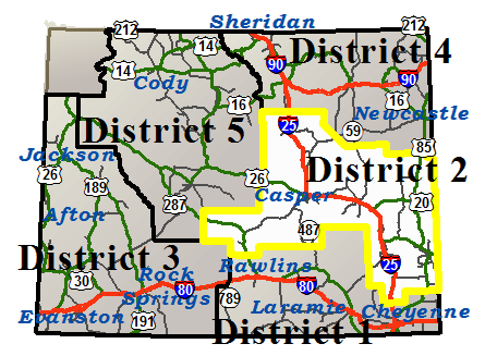
| District 2 (Central) | |
| Interstate 25 | |||||||
|---|---|---|---|---|---|---|---|
| Town | Location | Conditions | Advisories | Restrictions | Last Report Time | Cameras | Sensors |
|
Chugwater
NWS Forecast for Chugwater |
Between Exit 29, Whitaker Rd and Chugwater | Dry | None | None | Aug 2, 2026, 06:02 PM |

|

|
| Between Chugwater and Exit 73, WY 34 | Dry | None | None | Aug 2, 2026, 06:02 PM |
|
|
|
|
Wheatland
NWS Forecast for Wheatland |
Between Exit 73, WY 34 and Wheatland | Dry | None | None | Aug 2, 2026, 06:02 PM |
|
|
| Between Wheatland and Exit 92, US 26 | Dry | None | None | Aug 2, 2026, 06:02 PM |
|
|
|
|
Glendo
NWS Forecast for Glendo |
Between Exit 92, US 26 and Glendo | Dry | None | None | Aug 2, 2026, 06:02 PM |
|
|
| Between Glendo and Exit 126, US 18/20 | Dry | None | None | Aug 2, 2026, 06:02 PM |
|
|
|
|
Douglas
NWS Forecast for Douglas |
Between Exit 126, US 18/20 and Douglas | Dry | None | None | Aug 2, 2026, 06:02 PM |
|
|
| Between Douglas and Glenrock | Dry | None | None | Aug 2, 2026, 06:02 PM |
|
|
|
|
Casper
NWS Forecast for Casper |
Between Glenrock and Casper | Dry | None | None | Aug 2, 2026, 06:02 PM |
|
|
| Between Casper and Exit 210, Horse Ranch Creek Rd | Dry | None | I 25 / US 87 at milepost 191.640 Single unit 6+ axles: 36T |
Aug 2, 2026, 06:02 PM |
|
|
|
|
Midwest
NWS Forecast for Midwest |
Between Exit 210, Horse Ranch Creek Rd and Exit 227, WY 387 | Dry | None | None | Aug 2, 2026, 06:02 PM |
|
|
| Between Exit 227, WY 387 and Exit 235, Tisdale Mtn Rd | Dry | None | None | Aug 2, 2026, 06:02 PM |
|
|
|
|
Kaycee
NWS Forecast for Kaycee |
Between Exit 235, Tisdale Mtn Rd and Kaycee | Dry | None | None | Aug 2, 2026, 06:02 PM |
|
|
| Between Kaycee and Exit 265, Reno Rd | Dry | None | None | Aug 2, 2026, 06:02 PM |
|
|
|
|
Casper
NWS Forecast for Casper |
|||||||
|---|---|---|---|---|---|---|---|
| Route | Location | Conditions | Advisories | Restrictions | Last Report Time | Cameras | Sensors |
| Casper Service Road | Between WY 259 and Ormsby Road | Dry | None | I 25 SVRD at milepost 0.650 Single unit 2-3 axles: 20T , Single unit 4-5 axles: 20T , Single unit 6+ axles: 24T , Semi-trailer combos: 37T , Truck & full trailer combos: 36T |
Aug 2, 2026, 06:02 PM | ||
| Between Glenrock and Casper | Dry | None | None | Aug 2, 2026, 06:02 PM |
|
|
|
| Between Casper and Exit 210, Horse Ranch Creek Rd | Dry | None | I 25 / US 87 at milepost 191.640 Single unit 6+ axles: 36T |
Aug 2, 2026, 06:02 PM |
|
|
|
| US 20/26 | Between Waltman and Casper | Dry | None | None | Aug 2, 2026, 06:02 PM |
|
|
| US 20/26/87 | Between Glenrock and Casper | Dry | None | None | Aug 2, 2026, 06:02 PM |
|
|
| WY 220 | Between Pathfinder Rd and Alcova | Dry | None | None | Aug 2, 2026, 06:02 PM |
|
|
| Between Alcova and WY 487 | Dry | None | None | Aug 2, 2026, 06:02 PM |
|
||
| Between WY 487 and Casper | Dry | None | None | Aug 2, 2026, 06:02 PM |
|
||
| WY 251 | Between WY 258, Wyoming Blvd and End of State Route | Dry | None | None | Aug 2, 2026, 06:02 PM |
|
|
| WY 257 | Between WY 220 and Robertson Road | Dry | None | None | Aug 2, 2026, 06:02 PM | ||
| Between Robertson Road and US 20/26 | Dry | None | None | Aug 2, 2026, 06:02 PM | |||
| WY 258 | Between Mills and Evansville | Dry | None | None | Aug 2, 2026, 06:02 PM |
|
|
|
Chugwater
NWS Forecast for Chugwater |
|||||||
|---|---|---|---|---|---|---|---|
| Route | Location | Conditions | Advisories | Restrictions | Last Report Time | Cameras | Sensors |
| Chugwater Service Road | Between Laramie County Line and WY 321 | Dry | None | I 25 SVRD at milepost 26.580 Single unit 6+ axles: 32T |
Aug 2, 2026, 06:02 PM |
|
|
| Between Exit 29, Whitaker Rd and Chugwater | Dry | None | None | Aug 2, 2026, 06:02 PM |
|
|
|
| Between Chugwater and Exit 73, WY 34 | Dry | None | None | Aug 2, 2026, 06:02 PM |
|
|
|
| WY 313 | Between Chugwater and US 85 | Dry | None | None | Aug 2, 2026, 06:02 PM | ||
| WY 321 | Between Chugwater and I-25 | Dry | None | None | Aug 2, 2026, 06:02 PM | ||
|
Douglas
NWS Forecast for Douglas |
|||||||
|---|---|---|---|---|---|---|---|
| Route | Location | Conditions | Advisories | Restrictions | Last Report Time | Cameras | Sensors |
| I 25 / US 20/26/87 | Between Exit 126, US 18/20 and Douglas | Dry | None | None | Aug 2, 2026, 06:02 PM |
|
|
| Between Douglas and Glenrock | Dry | None | None | Aug 2, 2026, 06:02 PM |
|
|
|
| US 18/20 | Between I-25, Orin Jct and Lost Springs | Dry | None | None | Aug 2, 2026, 06:02 PM | ||
| WY 319 | Between Glendo and Jct US 18/20 | Dry | None | Single unit 4-5 axles: 26T , Single unit 6+ axles: 26T , Semi-trailer combos: 39T |
Aug 2, 2026, 06:02 PM | ||
| WY 59 | Between WY 94, Douglas and the Campbell/Converse Cty Line | Dry | None | None | Aug 2, 2026, 06:02 PM |
|
|
| WY 93 | Between Douglas and End of State Route | Dry | None | None | Aug 2, 2026, 06:02 PM | ||
| WY 95 | Between Glenrock and WY 93 | Dry | None | None | Aug 2, 2026, 06:02 PM | ||
|
Glendo
NWS Forecast for Glendo |
|||||||
|---|---|---|---|---|---|---|---|
| Route | Location | Conditions | Advisories | Restrictions | Last Report Time | Cameras | Sensors |
| I 25 / US 26/87 | Between Exit 92, US 26 and Glendo | Dry | None | None | Aug 2, 2026, 06:02 PM |
|
|
| Between Glendo and Exit 126, US 18/20 | Dry | None | None | Aug 2, 2026, 06:02 PM |
|
|
|
|
Kaycee
NWS Forecast for Kaycee |
|||||||
|---|---|---|---|---|---|---|---|
| Route | Location | Conditions | Advisories | Restrictions | Last Report Time | Cameras | Sensors |
| I 25 / US 87 | Between Exit 235, Tisdale Mtn Rd and Kaycee | Dry | None | None | Aug 2, 2026, 06:02 PM |
|
|
| Between Kaycee and Exit 265, Reno Rd | Dry | None | None | Aug 2, 2026, 06:02 PM |
|
|
|
| WY 192 | Between Kaycee and Linch | Dry | None | WY 192 at milepost 21.100 Single unit 4-5 axles: 23T , Single unit 6+ axles: 27T , Semi-trailer combos: 37T |
Aug 2, 2026, 06:02 PM | ||
| WY 196 | Between I-25 and Kaycee | Dry | None | None | Aug 2, 2026, 06:02 PM | ||
| Between Kaycee and Beaver Creek | Dry | None | None | Aug 2, 2026, 06:02 PM |
|
||
|
Lusk
NWS Forecast for Lusk |
|||||||
|---|---|---|---|---|---|---|---|
| Route | Location | Conditions | Advisories | Restrictions | Last Report Time | Cameras | Sensors |
| US 18/20 | Between Lost Springs and Lusk | Dry | None | None | Aug 2, 2026, 06:02 PM |
|
|
| US 20 | Between Lusk and the Nebraska State Line | Dry | None | None | Aug 2, 2026, 06:02 PM |
|
|
| US 85 | Between Jay Em and Lusk | Dry | None | None | Aug 2, 2026, 06:02 PM | ||
| Between Lusk and Mule Creek Jct | Dry | None | None | Aug 2, 2026, 06:02 PM |
|
||
| WY 270 | Between the Niobrara/Platte Cty Line and Manville | Dry | None | WY 270 from milepost 495.500 to 535.800 Width restriction: 8 ft 6 in |
Aug 2, 2026, 06:02 PM | ||
| Between Manville and US 18/85 | Dry | None | None | Aug 2, 2026, 06:02 PM | |||
|
Midwest
NWS Forecast for Midwest |
|||||||
|---|---|---|---|---|---|---|---|
| Route | Location | Conditions | Advisories | Restrictions | Last Report Time | Cameras | Sensors |
| I 25 / US 87 | Between Exit 210, Horse Ranch Creek Rd and Exit 227, WY 387 | Dry | None | None | Aug 2, 2026, 06:02 PM |
|
|
| Between Exit 227, WY 387 and Exit 235, Tisdale Mtn Rd | Dry | None | None | Aug 2, 2026, 06:02 PM |
|
|
|
| WY 192 | Between Linch and WY 387 | Dry | None | None | Aug 2, 2026, 06:02 PM | ||
| WY 259 | Between I-25 and Midwest | Dry | None | None | Aug 2, 2026, 06:02 PM | ||
| WY 387 | Between Midwest and Pine Tree Jct | Dry | None | None | Aug 2, 2026, 06:02 PM |
|
|
|
Muddy Gap
NWS Forecast for Muddy Gap |
|||||||
|---|---|---|---|---|---|---|---|
| Route | Location | Conditions | Advisories | Restrictions | Last Report Time | Cameras | Sensors |
| US 287 / WY 789 | Between Mile Marker 23 and Lamont | Dry | None | None | Aug 2, 2026, 06:02 PM | ||
| Between Lamont and Muddy Gap | Dry | None | None | Aug 2, 2026, 06:02 PM |
|
||
| Between Muddy Gap and Jeffrey City | Dry | None | None | Aug 2, 2026, 06:02 PM |
|
||
| Between Jeffrey City and Sweetwater Station Jct | Dry | None | None | Aug 2, 2026, 06:02 PM |
|
||
| WY 220 | Between Muddy Gap and Independence Rock | Dry | None | None | Aug 2, 2026, 06:02 PM |
|
|
| Between Independence Rock and Pathfinder Rd | Dry | None | None | Aug 2, 2026, 06:02 PM |
|
|
|
|
Shirley Basin
NWS Forecast for Shirley Basin |
|||||||
|---|---|---|---|---|---|---|---|
| Route | Location | Conditions | Advisories | Restrictions | Last Report Time | Cameras | Sensors |
| WY 487 | Between the South Jct WY 77 and the North Jct WY 77 | Dry | None | None | Aug 2, 2026, 06:02 PM |
|
|
| Between the North Jct WY 77 and WY 220 | Dry | None | None | Aug 2, 2026, 06:02 PM |
|
||
| WY 77 | Between the South Jct WY 487 and Mile Marker 132, Northbound Closure Gate | Dry | None | WY 77 from milepost 122.100 to 144.200 Weight restriction: 80000 lbs |
Aug 2, 2026, 06:02 PM | ||
| Between Mile Marker 132, Northbound Closure Gate and Mile Marker 142, Southbound Closure Gate | Dry | None | None | Aug 2, 2026, 06:02 PM | |||
| Between Mile Marker 142, Southbound Closure Gate and the North Jct WY 487 | Dry | None | WY 77 from milepost 122.100 to 144.200 Weight restriction: 80000 lbs |
Aug 2, 2026, 06:02 PM | |||
|
Torrington
NWS Forecast for Torrington |
|||||||
|---|---|---|---|---|---|---|---|
| Route | Location | Conditions | Advisories | Restrictions | Last Report Time | Cameras | Sensors |
| US 26 | Between Guernsey and Lingle | Dry | None | None | Aug 2, 2026, 06:02 PM | ||
| Between Torrington and the Nebraska State Line | Dry | None | None | Aug 2, 2026, 06:02 PM | |||
| US 85 | Between Meriden and WY 151, Bear Mountain Station | Dry | None | None | Aug 2, 2026, 06:02 PM |
|
|
| Between WY 151, Bear Mountain Station and WY 161, Silvertip | Dry | None | None | Aug 2, 2026, 06:02 PM | |||
| Between WY 161, Silvertip and Torrington | Dry | None | None | Aug 2, 2026, 06:02 PM | |||
| Between Torrington and Lingle | Dry | None | None | Aug 2, 2026, 06:02 PM | |||
| Between Lingle and Jay Em | Dry | None | None | Aug 2, 2026, 06:02 PM |
|
||
|
Wheatland
NWS Forecast for Wheatland |
|||||||
|---|---|---|---|---|---|---|---|
| Route | Location | Conditions | Advisories | Restrictions | Last Report Time | Cameras | Sensors |
| I 25 / US 87 | Between Exit 73, WY 34 and Wheatland | Dry | None | None | Aug 2, 2026, 06:02 PM |
|
|
| Between Wheatland and Exit 92, US 26 | Dry | None | None | Aug 2, 2026, 06:02 PM |
|
|
|
| US 26 | Between I-25, Dwyer Jct and Guernsey | Dry | None | None | Aug 2, 2026, 06:02 PM | ||
| WY 270 | Between Guernsey and the Niobrara/Platte Cty Line | Dry | None | None | Aug 2, 2026, 06:02 PM | ||
| WY 319 | Between I-25 / US 26/87 and US 18/20 | Dry | None | WY 319 at milepost 106.350 Single unit 4-5 axles: 28T , Single unit 6+ axles: 30T |
Aug 2, 2026, 06:02 PM |
|
|
| WY 320 | Between Wheatland and Grey Rocks Closure Gate | Dry | None | None | Aug 2, 2026, 06:02 PM | ||
| Between Grey Rocks Closure Gate and US 26 | Dry | None | WY 320 at milepost 2.520 Single unit 6+ axles: 34T |
Aug 2, 2026, 06:02 PM | |||
| WY 34 | Between the Platte/Albany Cty Line and Tally Ho Ranch | Dry | None | None | Aug 2, 2026, 06:02 PM | ||
| Between Tally Ho Ranch and I-25 | Dry | None | None | Aug 2, 2026, 06:02 PM | |||
|
NWS Forecast for |
|||||||
|---|---|---|---|---|---|---|---|
| Route | Location | Conditions | Advisories | Restrictions | Last Report Time | Cameras | Sensors |
|
NWS Forecast for |
|||||||
|---|---|---|---|---|---|---|---|
| Route | Location | Conditions | Advisories | Restrictions | Last Report Time | Cameras | Sensors |
|
NWS Forecast for |
|||||||
|---|---|---|---|---|---|---|---|
| Route | Location | Conditions | Advisories | Restrictions | Last Report Time | Cameras | Sensors |
|
NWS Forecast for |
|||||||
|---|---|---|---|---|---|---|---|
| Route | Location | Conditions | Advisories | Restrictions | Last Report Time | Cameras | Sensors |
| *Chain Law - Level 1 Definition |
| **Chain Law - Level 2 Definition |
| Other Definitions |
| Impact Levels | Description / Recommended Action |
|---|---|
| Low | Minimal impacts expected, use general caution. |
| Moderate | Some impacts expected, use extra caution. Stay alert for changing road and weather conditions. |
| High | Dangerous impacts expected, use extreme caution, delay travel or consider alternate route. If travel is necessary, slow down and allow extra time. |
| CLOSED | Per W.S. 24-1-109, motorists traveling on a closed road without permission from WYDOT or WHP may be subject to a fine of up to $750 and/or up to 30 days imprisonment. |
| Seasonal / Long-Duration Event | Impact level used to distinguish long-duration events from emergent events. |
|
|
|
| Citizen | Business | Government | Visitor | Contact Us | Copyright © 2026 State of Wyoming | Disclaimer | Privacy Policy | Media |
| Production Laramie v. 1.2.0.2746-20260728 | ||||||||