
|
Last update at: Apr 15, 2025, 12:06 AM
Go to Top
Go to Top
Go to Top
Go to Top
Go to Top
Go to Top
Go to Top
Go to Top
Go to Top
Go to Top
Go to Top
Go to Top
Go to Top
Go to Top
Go to Top
|
Frequently Asked Questions Printer Friendly Version |
|
Closures & Advisories Search Conditions By Map Search By City Search By Route Search By District Variable Speed Limits Chain Law Neighboring States |

| District Comments | |
|---|---|
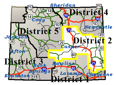
| District 2 (Central) | I25: Crash Clean-up, Right lane blocked NORTHBOUND between Cheyenne and Chugwater at milepost 37, Expect delays. |
| Interstate 25 | |||||||
|---|---|---|---|---|---|---|---|
| Town | Location | Conditions | Advisories | Restrictions | Last Report Time | Cameras | Sensors |
|
Chugwater
NWS Forecast |
Between Exit 29, Whitaker Rd and Chugwater | Dry | None | None | Apr 15, 2025, 12:06 AM |

|

|
| Between Chugwater and Exit 73, WY 34 | Dry | None | None | Apr 15, 2025, 12:06 AM |
|
|
|
|
Wheatland
NWS Forecast |
Between Exit 73, WY 34 and Wheatland | Dry | None | None | Apr 15, 2025, 12:06 AM |
|
|
| Between Wheatland and Exit 92, US 26 | Dry | None | None | Apr 15, 2025, 12:06 AM |
|
||
|
Glendo
NWS Forecast |
Between Exit 92, US 26 and Glendo | Dry | None | None | Apr 15, 2025, 12:06 AM |
|
|
| Between Glendo and Exit 126, US 18/20 | Dry | None | None | Apr 15, 2025, 12:06 AM |
|
|
|
|
Douglas
NWS Forecast |
Between Exit 126, US 18/20 and Douglas | Dry | None | None | Apr 15, 2025, 12:06 AM |
|
|
| Between Douglas and Glenrock | Dry | None | None | Apr 15, 2025, 12:06 AM |
|
|
|
|
Casper
NWS Forecast |
Between Glenrock and Casper | Dry | None | None | Apr 15, 2025, 12:06 AM |
|
|
| Between Casper and Exit 210, Horse Ranch Creek Rd | Dry | None |
I 25 , US 20 , US 26 , US 87 from milepost 187.530 to 189.510 Width restriction: 12 ft I 25 / US 87 at milepost 191.640 Single unit 6+ axles: 36T |
Apr 15, 2025, 12:06 AM |
|
|
|
|
Midwest
NWS Forecast |
Between Exit 210, Horse Ranch Creek Rd and Exit 227, WY 387 | Dry | None | None | Apr 15, 2025, 12:06 AM |
|
|
| Between Exit 227, WY 387 and Exit 235, Tisdale Mtn Rd | Dry | None | None | Apr 15, 2025, 12:06 AM |
|
|
|
|
Kaycee
NWS Forecast |
Between Exit 235, Tisdale Mtn Rd and Kaycee | Dry | None | None | Apr 15, 2025, 12:06 AM |
|
|
| Between Kaycee and Exit 265, Reno Rd | Dry | None | None | Apr 15, 2025, 12:06 AM |
|
|
|
|
Casper
NWS Forecast Casper |
|||||||
|---|---|---|---|---|---|---|---|
| Route | Location | Conditions | Advisories | Restrictions | Last Report Time | Cameras | Sensors |
| Casper Service Road | Between WY 259 and Ormsby Road | Dry | None |
I 25 SVRD at milepost 0.650 Single unit 2-3 axles: 20T , Single unit 4-5 axles: 20T , Single unit 6+ axles: 24T , Semi-trailer combos: 37T , Truck & full trailer combos: 36T |
Apr 15, 2025, 12:06 AM | ||
| Between Glenrock and Casper | Dry | None | None | Apr 15, 2025, 12:06 AM |
|
|
|
| Between Casper and Exit 210, Horse Ranch Creek Rd | Dry | None |
I 25 , US 20 , US 26 , US 87 from milepost 187.530 to 189.510 Width restriction: 12 ft I 25 / US 87 at milepost 191.640 Single unit 6+ axles: 36T |
Apr 15, 2025, 12:06 AM |
|
|
|
| US 20/26 | Between Waltman and Casper | Dry | None | None | Apr 15, 2025, 12:06 AM |
|
|
| US 20/26/87 | Between Glenrock and Casper | Dry | None | None | Apr 15, 2025, 12:06 AM |
|
|
| WY 220 | Between Pathfinder Rd and Alcova | Dry | None | None | Apr 15, 2025, 12:06 AM |
|
|
| Between Alcova and WY 487 | Dry | None | None | Apr 15, 2025, 12:06 AM |
|
||
| Between WY 487 and Casper | Dry | None | None | Apr 15, 2025, 12:06 AM |
|
||
| WY 251 | Between WY 258, Wyoming Blvd and End of State Route | Dry | None | None | Apr 15, 2025, 12:06 AM |
|
|
| WY 257 | Between WY 220 and Robertson Road | Dry | None | None | Apr 15, 2025, 12:06 AM | ||
| Between Robertson Road and US 20/26 | Dry | None | None | Apr 15, 2025, 12:06 AM | |||
| WY 258 | Between Mills and Evansville | Dry | None | None | Apr 15, 2025, 12:06 AM |
|
|
|
Chugwater
NWS Forecast Chugwater |
|||||||
|---|---|---|---|---|---|---|---|
| Route | Location | Conditions | Advisories | Restrictions | Last Report Time | Cameras | Sensors |
| Chugwater Service Road | Between Laramie County Line and WY 321 | Dry | None |
I 25 SVRD at milepost 26.580 Single unit 6+ axles: 32T |
Apr 15, 2025, 12:06 AM |
|
|
| Between Exit 29, Whitaker Rd and Chugwater | Dry | None | None | Apr 15, 2025, 12:06 AM |
|
|
|
| Between Chugwater and Exit 73, WY 34 | Dry | None | None | Apr 15, 2025, 12:06 AM |
|
|
|
| WY 313 | Between Chugwater and US 85 | Dry | None | None | Apr 15, 2025, 12:06 AM | ||
| WY 321 | Between Chugwater and I-25 | Dry | None | None | Apr 15, 2025, 12:06 AM | ||
|
Douglas
NWS Forecast Douglas |
|||||||
|---|---|---|---|---|---|---|---|
| Route | Location | Conditions | Advisories | Restrictions | Last Report Time | Cameras | Sensors |
| I 25 / US 20/26/87 | Between Exit 126, US 18/20 and Douglas | Dry | None | None | Apr 15, 2025, 12:06 AM |
|
|
| Between Douglas and Glenrock | Dry | None | None | Apr 15, 2025, 12:06 AM |
|
|
|
| US 18/20 | Between I-25, Orin Jct and Lost Springs | Dry | None | None | Apr 15, 2025, 12:06 AM | ||
| WY 319 | Between Glendo and Jct US 18/20 | Dry | None |
Single unit 4-5 axles: 26T , Single unit 6+ axles: 26T , Semi-trailer combos: 39T |
Apr 15, 2025, 12:06 AM | ||
| WY 59 | Between WY 94, Douglas and the Campbell/Converse Cty Line | Dry | None |
WY 59 from milepost 19.300 to 27.000 Width restriction: 12 ft |
Apr 15, 2025, 12:06 AM |
|
|
| WY 93 | Between Douglas and End of State Route | Dry | None | None | Apr 15, 2025, 12:06 AM | ||
| WY 95 | Between Glenrock and WY 93 | Dry | None | None | Apr 15, 2025, 12:06 AM | ||
|
Glendo
NWS Forecast Glendo |
|||||||
|---|---|---|---|---|---|---|---|
| Route | Location | Conditions | Advisories | Restrictions | Last Report Time | Cameras | Sensors |
| I 25 / US 26/87 | Between Exit 92, US 26 and Glendo | Dry | None | None | Apr 15, 2025, 12:06 AM |
|
|
| Between Glendo and Exit 126, US 18/20 | Dry | None | None | Apr 15, 2025, 12:06 AM |
|
|
|
|
Kaycee
NWS Forecast Kaycee |
|||||||
|---|---|---|---|---|---|---|---|
| Route | Location | Conditions | Advisories | Restrictions | Last Report Time | Cameras | Sensors |
| I 25 / US 87 | Between Exit 235, Tisdale Mtn Rd and Kaycee | Dry | None | None | Apr 15, 2025, 12:06 AM |
|
|
| Between Kaycee and Exit 265, Reno Rd | Dry | None | None | Apr 15, 2025, 12:06 AM |
|
|
|
| WY 192 | Between Kaycee and Linch | Dry | None |
WY 192 at milepost 21.100 Single unit 4-5 axles: 23T , Single unit 6+ axles: 27T , Semi-trailer combos: 37T |
Apr 15, 2025, 12:06 AM | ||
| WY 196 | Between I-25 and Kaycee | Dry | None | None | Apr 15, 2025, 12:06 AM | ||
| Between Kaycee and Beaver Creek | Dry | None | None | Apr 15, 2025, 12:06 AM |
|
||
|
Lusk
NWS Forecast Lusk |
|||||||
|---|---|---|---|---|---|---|---|
| Route | Location | Conditions | Advisories | Restrictions | Last Report Time | Cameras | Sensors |
| US 18/20 | Between Lost Springs and Lusk | Dry | None | None | Apr 15, 2025, 12:06 AM |
|
|
| US 20 | Between Lusk and the Nebraska State Line | Dry | None | None | Apr 15, 2025, 12:06 AM |
|
|
| US 85 | Between Jay Em and Lusk | Dry | None | None | Apr 15, 2025, 12:06 AM | ||
| Between Lusk and Mule Creek Jct | Dry | None | None | Apr 15, 2025, 12:06 AM |
|
||
| WY 270 | Between the Niobrara/Platte Cty Line and Manville | Dry | None | None | Apr 15, 2025, 12:06 AM | ||
| Between Manville and US 18/85 | Dry | None | None | Apr 15, 2025, 12:06 AM | |||
|
Midwest
NWS Forecast Midwest |
|||||||
|---|---|---|---|---|---|---|---|
| Route | Location | Conditions | Advisories | Restrictions | Last Report Time | Cameras | Sensors |
| I 25 / US 87 | Between Exit 210, Horse Ranch Creek Rd and Exit 227, WY 387 | Dry | None | None | Apr 15, 2025, 12:06 AM |
|
|
| Between Exit 227, WY 387 and Exit 235, Tisdale Mtn Rd | Dry | None | None | Apr 15, 2025, 12:06 AM |
|
|
|
| WY 192 | Between Linch and WY 387 | Dry | None | None | Apr 15, 2025, 12:06 AM | ||
| WY 259 | Between I-25 and Midwest | Dry | None | None | Apr 15, 2025, 12:06 AM | ||
| WY 387 | Between Midwest and Pine Tree Jct | Dry | None | None | Apr 15, 2025, 12:06 AM |
|
|
|
Muddy Gap
NWS Forecast Muddy Gap |
|||||||
|---|---|---|---|---|---|---|---|
| Route | Location | Conditions | Advisories | Restrictions | Last Report Time | Cameras | Sensors |
| US 287 / WY 789 | Between Mile Marker 23 and Lamont | Dry | None | None | Apr 15, 2025, 12:06 AM | ||
| Between Lamont and Muddy Gap | Dry | None | None | Apr 15, 2025, 12:06 AM |
|
||
| Between Muddy Gap and Jeffrey City | Dry | None | None | Apr 15, 2025, 12:06 AM |
|
||
| Between Jeffrey City and Sweetwater Station Jct | Dry | None | None | Apr 15, 2025, 12:06 AM |
|
||
| WY 220 | Between Muddy Gap and Independence Rock | Dry | None | None | Apr 15, 2025, 12:06 AM |
|
|
| Between Independence Rock and Pathfinder Rd | Dry | None | None | Apr 15, 2025, 12:06 AM |
|
|
|
|
Shirley Basin
NWS Forecast Shirley Basin |
|||||||
|---|---|---|---|---|---|---|---|
| Route | Location | Conditions | Advisories | Restrictions | Last Report Time | Cameras | Sensors |
| WY 487 | Between the South Jct WY 77 and the North Jct WY 77 | Dry | None | None | Apr 15, 2025, 12:06 AM |
|
|
| Between the North Jct WY 77 and WY 220 | Dry | None | None | Apr 15, 2025, 12:06 AM |
|
||
| WY 77 | Between the South Jct WY 487 and Mile Marker 132, Northbound Closure Gate | Dry | None |
WY 77 from milepost 122.100 to 144.280 Weight restriction: 80000 lbs |
Apr 15, 2025, 12:06 AM | ||
| Between Mile Marker 132, Northbound Closure Gate and Mile Marker 142, Southbound Closure Gate | Dry | None | None | Apr 15, 2025, 12:06 AM | |||
| Between Mile Marker 142, Southbound Closure Gate and the North Jct WY 487 | Dry | None |
WY 77 from milepost 122.100 to 144.280 Weight restriction: 80000 lbs |
Apr 15, 2025, 12:06 AM | |||
|
Torrington
NWS Forecast Torrington |
|||||||
|---|---|---|---|---|---|---|---|
| Route | Location | Conditions | Advisories | Restrictions | Last Report Time | Cameras | Sensors |
| US 26 | Between Guernsey and Lingle | Dry | None | None | Apr 15, 2025, 12:06 AM | ||
| Between Torrington and the Nebraska State Line | Dry | None | None | Apr 15, 2025, 12:06 AM | |||
| US 85 | Between Meriden and WY 151, Bear Mountain Station | Dry | None | None | Apr 15, 2025, 12:06 AM |
|
|
| Between WY 151, Bear Mountain Station and WY 161, Silvertip | Dry | None | None | Apr 15, 2025, 12:06 AM | |||
| Between WY 161, Silvertip and Torrington | Dry | None | None | Apr 15, 2025, 12:06 AM | |||
| Between Torrington and Lingle | Dry | None | None | Apr 15, 2025, 12:06 AM | |||
| Between Lingle and Jay Em | Dry | None | None | Apr 15, 2025, 12:06 AM |
|
||
|
Wheatland
NWS Forecast Wheatland |
|||||||
|---|---|---|---|---|---|---|---|
| Route | Location | Conditions | Advisories | Restrictions | Last Report Time | Cameras | Sensors |
| I 25 / US 87 | Between Exit 73, WY 34 and Wheatland | Dry | None | None | Apr 15, 2025, 12:06 AM |
|
|
| Between Wheatland and Exit 92, US 26 | Dry | None | None | Apr 15, 2025, 12:06 AM |
|
||
| US 26 | Between I-25, Dwyer Jct and Guernsey | Dry | None | None | Apr 15, 2025, 12:06 AM | ||
| WY 270 | Between Guernsey and the Niobrara/Platte Cty Line | Dry | None | None | Apr 15, 2025, 12:06 AM | ||
| WY 319 | Between I-25 / US 26/87 and US 18/20 | Dry | None |
WY 319 at milepost 106.350 Single unit 6+ axles: 35T |
Apr 15, 2025, 12:06 AM |
|
|
| WY 320 | Between Wheatland and Grey Rocks Closure Gate | Dry | None | None | Apr 15, 2025, 12:06 AM | ||
| Between Grey Rocks Closure Gate and US 26 | Dry | None |
WY 320 at milepost 2.520 Single unit 6+ axles: 34T |
Apr 15, 2025, 12:06 AM | |||
| WY 34 | Between the Platte/Albany Cty Line and Tally Ho Ranch | Dry | None | None | Apr 15, 2025, 12:06 AM | ||
| Between Tally Ho Ranch and I-25 | Dry | None | None | Apr 15, 2025, 12:06 AM | |||
|
NWS Forecast |
|||||||
|---|---|---|---|---|---|---|---|
| Route | Location | Conditions | Advisories | Restrictions | Last Report Time | Cameras | Sensors |
|
NWS Forecast |
|||||||
|---|---|---|---|---|---|---|---|
| Route | Location | Conditions | Advisories | Restrictions | Last Report Time | Cameras | Sensors |
|
NWS Forecast |
|||||||
|---|---|---|---|---|---|---|---|
| Route | Location | Conditions | Advisories | Restrictions | Last Report Time | Cameras | Sensors |
|
NWS Forecast |
|||||||
|---|---|---|---|---|---|---|---|
| Route | Location | Conditions | Advisories | Restrictions | Last Report Time | Cameras | Sensors |
| *Chain Law - Level 1 Definition |
| **Chain Law - Level 2 Definition |
| Other Definitions |
| Impact Levels | Description / Recommended Action |
|---|---|
| Low | Minimal impacts expected, use general caution. |
| Moderate | Some impacts expected, use extra caution. Stay alert for changing road and weather conditions. |
| High | Dangerous impacts expected, use extreme caution, delay travel or consider alternate route. If travel is necessary, slow down and allow extra time. |
| CLOSED | Per W.S. 24-1-109, motorists traveling on a closed road without permission from WYDOT or WHP may be subject to a fine of up to $750 and/or up to 30 days imprisonment. |
| Seasonal / Long-Duration Event | Impact level used to distinguish long-duration events from emergent events. |
|
|
|
| Citizen | Business | Government | Visitor | Contact Us | Copyright © 2024 State of Wyoming | Disclaimer | Privacy Policy | Media |
| Production Cheyenne v. 1.2.0.1938-20241016 | ||||||||